
Driving and Hiking Directions to
Maine Lighthouses
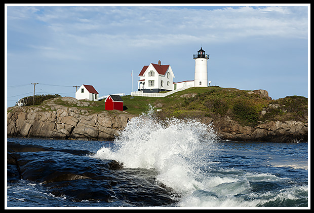
Cape Neddick (Nubble) Lighthouse
(Heading Northward)
There are 65 lighthouse locations in Maine, and many can be hiked to or viewed close up without having to take a boat cruise or tour. Here’s a list of lighthouses that visitors can drive or hike to and explore. Links are also provided to each individual lighthouse page where you can find more detailed information on that lighthouse, and places to visit near the light.
Island lighthouses are also provided where you may need a ferry or shuttle to access, but once on the island you can hike to these lights. Ferry links are included here to schedule your trip.
Drive or Hike to These
Lighthouses in Southern Maine

Whaleback Lighthouse
Whaleback Light, Kittery, Maine
Take Exit 2 from Route 95 for Route 1 and 236. Follow along Route 236 onto Route 103, then right at Chaucey Creek Road, right at Gerrish Island Street, to Pocohontas Avenue, to the gate to Fort Foster Park. Lighthouse a short distance at the end.
Nubble (Cape Neddick) Light, York, Maine
Take Route 1 to Route 1A to York beach, follow Nubble to Sohier Park.
Goat Island (Cape Porpoise) Light, Kennebunk, Maine
Take Route 1 to Route 9E into Kennebunkport, bear right at fork by Cape Porpoise Post Office onto Wharf Street to Pier Street. Lighthouse viewed at distance.
Cape Elizabeth Light, Cape Elizabeth, Maine
(private residence)
Take Route 1 to Route 207 in Scarborough. Follow Route 77 over five miles, right on Two Lights Street, bear right towards Two Lights Park, keep left to the beach.
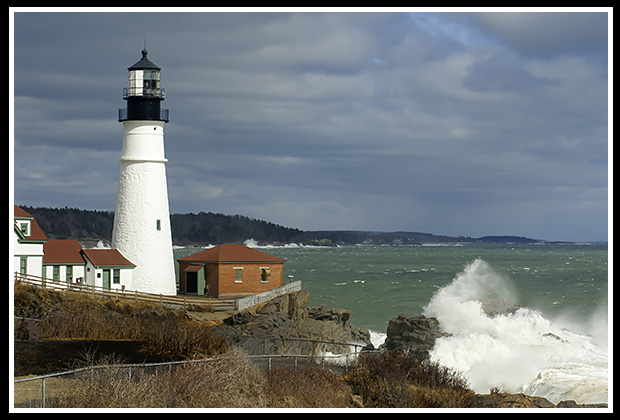
Portland Head Lighthouse
Portland Head Lighthouse, Cape Elizabeth, Maine
From Route 1 to Route 1A outside Portland, take Route 77 South to South Portland to Shore, the follow to Fort Williams Park to the light.
Ram Island Ledge Lighthouse, Cape Elizabeth, Maine
From Route 1 to Route 1A outside Portland, take Route 77 South to South Portland to Shore Road, then follow to Fort Williams Park to view light from distance.
Spring Point Light, South Portland, Maine
Take Exit 6A from Route 1 onto Broadway Street (Route 77) to Pickett, then left on Fort Street, right to Fort Preble Street through University. Can also take Route 77 onto Broadway Street.
Portland Breakwater (Bug) Light, South Portland, Maine
Take Exit 6A from Route 1 onto Broadway Street (Route 77) to Pickett, then left on Fort Street to boat ramp, to Bug Light Park.
Drive or Hike to These
Mid Coast Maine Lighthouses
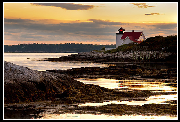
Hendricks Head Lighthouse
Squirrel Point Light, Arrowsic, Maine
From Route 1 in Bath, Route 127 South, right on Steen Street. Right at fork on dirt road, then left on Bald Head Street to the end. Take first footpath from dirt parking lot. It’s a mile long hike in trail in woods to the light.
Doubling Point Light, Arrowsic, Maine (private residence)
From Route 1 in Bath, Route 127 South for 2 miles to Doubling Point Road (dirt road), bear right at fork. Ask permission.
Doubling Point Range Lights, Arrowsic, Maine (private residence)
Take Route 1 in Bath, Route 127 South for 2 miles to Doubling Point Road (dirt road), bear left at fork. Ask permission.
Hendricks Head Light, Southport, Maine
From Route1, take Route 27 South to Boothbay towards Southport. Take Lakeside Drive about 10 miles, to Southport Grocery Store. Take right and follow Beach Street for 3 miles to light.
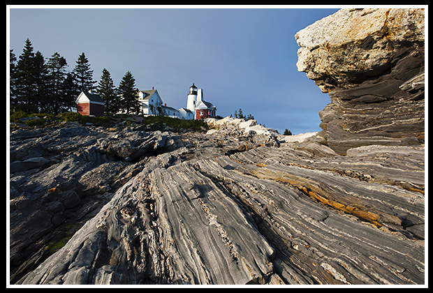
Pemaquid Point Lighthouse
Pemaquid Point Light, Bristol, Maine
Take Route 1 in Damariscotta to Route 129 South three miles to Route 130 South for 12 miles to Pemaquid Point.
Marshall Point Light, Port Clyde, Maine
From Route 1 in Thomaston, take Route 131 to Port Clyde, left at intersection, right after restaurant, then left at Marshall Point Road to the light.
Rockland Harbor Southwest Light, Rockland, Maine (private residence)
From Route 1 in Rockland, take Route 73 to the end of Everett Avenue.
Owls Head Light, Rockland, Maine
From Route 1 in Rockland, take Route 73 to left at North Shore Drive, then left at Owls Head Post Office to Lighthouse Road. Hike ½ mile from parking lot.
Rockland Breakwater Light, Rockland, Maine
From Route 1 in Rockland, take right on Waldo Avenue, then right on Samoset Drive to parking lot. Lighthouse at the end of one-mile breakwater to walk.
Curtis Island Light, Camden, Maine
A decent distant view can be seen when you take Route 1 to Camden, take right on Chestnut Street past Post Office, left on Penobscot Street, left at next stop sign. Bear left and you’ll see lighthouse from residential area.
Dice Head Light, Castine, Maine
From Route 1 in Orland, take Route 175 South to Route 166 past Maine Maritime Academy to Battle Avenue to the lighthouse.
Maine Island Lighthouses
Accessible by Ferry
You Can Drive or Hike To
These lighthouses are accessible by ferry where you can get onto their island location and explore the lighthouse grounds and nearby attractions. Select the ferry link to access contact information to schedule your trip.
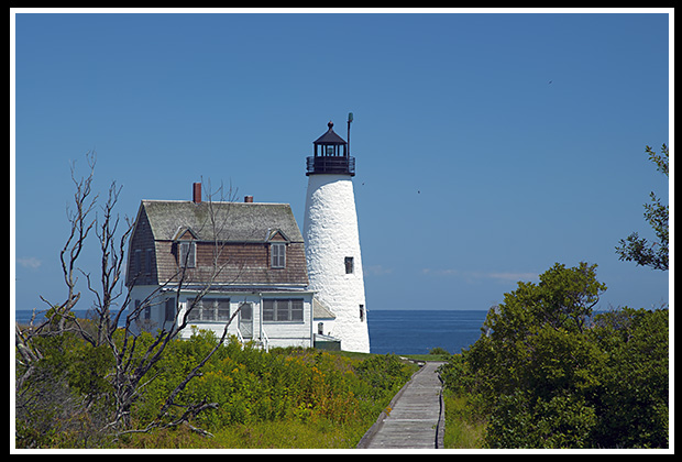
Wood Island Lighthouse
Wood Island Light, Biddeford Pool, Maine
From Route 1 in Biddeford, take Route 111, then right at lights to Route 9/208 for five miles to Biddeford Pool. Take left at end, bear right past fire station to parking lot for dock. Take the shuttle by the Friends of Wood Island Light, they also perform the tours and guide you from the dock to the lighthouse.
Seguin Island Light, Georgetown, Maine
Fish ‘N’ Trips boat service provides ferry service to Sequin Island from Fort Popham, where you need to hike uphill a steep grade to the light.
Monhegan Island Light, Monhegan Island, Maine
Monhegan Boat Line, among others, provides a shuttle from Port Clyde to Monhegan Island where you take a left off the dock and bear right uphill to reach the lighthouse and grounds.
Browns Head Light, Vinalhaven Island, Maine
Take the Maine State Ferry out of Rockland to arrive at Vinalhaven Island. At the terminal, take a right out of the lot, then left by Key Bank. Bear right at fork by yield sign, then left at fork with “No Open Fires” sign and follow for 4 miles. Take dirt road on left past cemetery, then take next right on dirt road to the light.
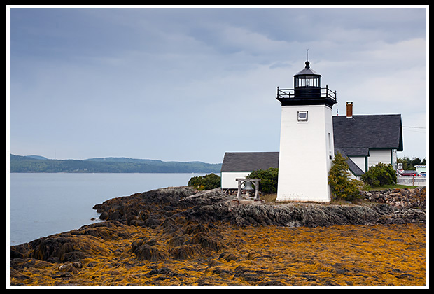
Grindle Point Lighthouse
Grindle Point Light, Islesboro, Maine
Take the Islesboro Ferry (State Ferry) out of Lincolnville and lighthouse is right at the dock on Islesboro Island.
Burnt Island Light, Boothbay Harbor, Maine
Balmy Days Cruises provides a frequent shuttle out of Boothbay Harbor to the island where you are provided a guided tour to the lighthouse and grounds.
Isle au Haut Light, Isle au Haut, Maine
Take the Isle au Haut Ferry out of Stonington to arrive at Isle au Haut at the lighthouse.
Burnt Coat Harbor, Swan’s Island, Maine
Take the Swan’s Island Ferry to reach Swan’s Island. Turn right from the landing, then right at T-intersection, then bear right at fork for
2 1/2 miles into the town of Swan’s Island. Bear left on Main Street for another 5 miles to the light.
Drive or Hike to
Downeast Maine Lighthouses
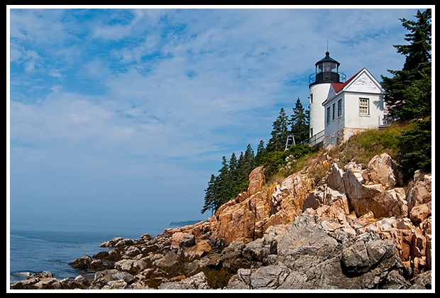
Bass Harbor Lighthouse
Bas Harbor Light, Trenton, Maine
From Route 1 in Ellsworth, take Route 3 to Mount Desert Island. Take right on Route 102 then stay right to 102A to the light.
Prospect Harbor Light, Prospect Harbor, Maine (military grounds)
From Route 1, take Route186 to Prospect Harbor, right on Route 195, then bear right at fork to Lighthouse Point. View outside of military gates, can’t enter.
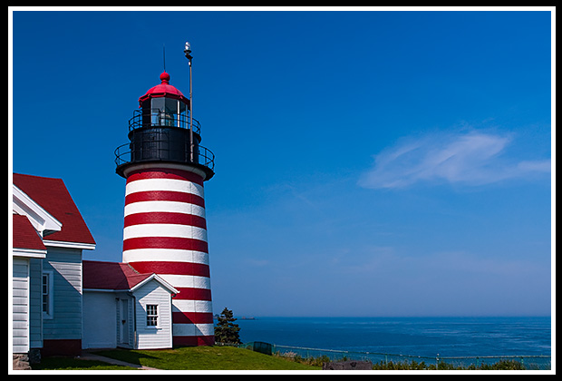
West Quoddy Head Lighthouse
West Quoddy Head Light, Lubec, Maine
From Route 1, take Route 189 towards Lubec. Turn right after 10 miles to Quoddy Head State Park for five miles.
Whitlocks Mill Light, Calais, Maine
(private residence)
Route 1 in Calais, view lighthouse from Saint Croix River Rest Area only. Do not go near lighthouse grounds, grumpy dogs and owner live there.
Books to Explore
Lighthouses and Coastal Attractions of Northern New England: New Hampshire, Maine, and Vermont, published by Schiffer Publishing, provides human interest stories from each of the 76 lighthouses, along with the coastal attractions and tours near each beacon, and contact info to plan your special trips. You'll find over 360 images inside as well. Look inside! |
|
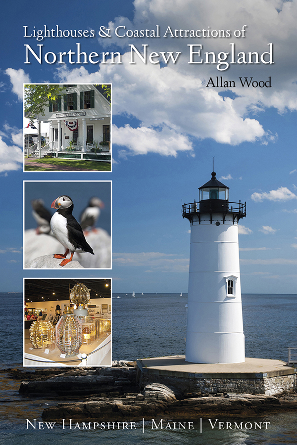

Available in paperback, hard cover, and as an eBook for all devices.
|
The Rise and Demise of the Largest Sailing Ships: In the early 1900s, New England shipbuilders constructed the world’s largest sailing ships amid social and political reforms. These giants of sail were the ten original six-masted coal schooners and one colossal seven-masted vessel, built to carry massive quantities of coal and building supplies, and measured longer than a football field! This book, balanced with plenty of color and vintage images, showcases the historical accounts that followed these mighty ships. These true stories include competitions, accidents, battling destructive storms, acts of heroism, and their final voyages. |