Fort Point Lighthouse
207 Lighthouse Road, Stockton Springs, Maine
Built in 1836
Location:
On the western side entrance of the Penobscot River, off Fort Point Road inside Fort Point State Park. Lighthouse buildings and tower are private residence, but the grounds are open to the public.
Latitude: 44° 28' 02" N
Longitude: 68° 48' 42" W
Historic Stories:
A famous land and sea battle of disastrous proportions was fought here on August 14, 1799. Under the command of Colonel Paul Revere and Commodore Dudley Saltonstall, 43 American ships were sunk and scattered all over this area of Penobscot Bay, and 1,000 soldiers fled from a smaller force of British ships and troops.
With the booming lumber trade heading to Bangor, and increased shipping of Maine potatoes, there became the need for a lighthouse to guide traffic along the Penobscot River.
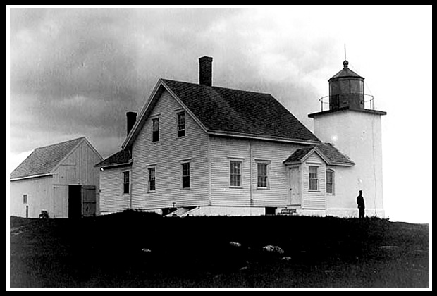
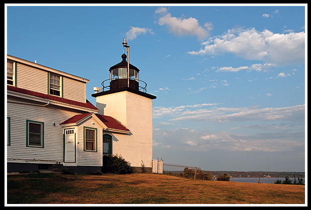
| Fort Point lighthouse, was built in 1836 under the presidency of Andrew Jackson, it was rebuilt in 1857. It stands 88 feet high above the sea. |
Fort Point Light Vintage Image |
|
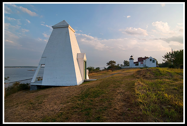
The unique bell tower is one of the few bell towers left in Maine. |
It is listed in the National Register of Historic Places. The original fog bell house still exists.
The outside of the lighthouse is square while the inside contains brick interior lining and stairs going around in a circular pattern, making it the only unique structure of its type in Maine. The story goes that when constructing the tower, a spiral staircase was located nearby in great condition, but the plans called for a square construction outside, so the government carpenter simply used the spiral staircase inside while keeping to the original square design for the tower.
The Fort Point Hotel was a luxury hotel constructed near the lighthouse in 1872 to bring wealthy tourists to the area. The hotel had such luxuries as running water, gaslights, stables, a bowling alley, and two dance pavilions. The hope was that it would rival Bar Harbor, but was unsuccessful and mysteriously burned to the ground four years later.
Because of its desirable location, the lighthouse had only four lucky keepers stationed there from the 1880’s into the 1930’s.
The light was automated in 1988. The lighthouse was leased to the Maine State Bureau of Parks and Land by the Coast Guard in 1989 and has since served as housing for the park supervisor. The deed to the lighthouse was transferred to the State of Maine in 1998 under the Maine Lights Program.
Places to Visit Nearby:
Fort Point Lighthouse is set in a quiet remote area on a hilltop and resides within the small artist community of Searsport, which is also home of the Penobscot Marine Museum. The museum includes eight historic buildings housing collections of marine art, artifacts, and maritime heritage. This historic town has plenty of specialty shops, restaurants, and antique shops to explore. The lighthouse and the grounds are part of Fort Point State Park, encompassing 120 acres on a peninsula with panoramic views of the Penobscot River and Penobscot Bay. Visitors can hike through trails that lead through fields and wooded areas, down to rocky shores and explore historic sites. There is also a seven-mile loop around Cape Jellison for hikers and bikers.
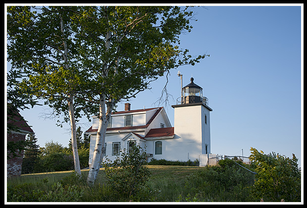
The lighthouse itself is closed to the public, as the state park supervisor and his family occupy the keeper’s dwelling all year.
|
However, visitors are allowed to explore the grounds and photograph the lighthouse. |
You can relax and picnic at Fort Point State Park, which is part of the lighthouse grounds, and walk along some of the short trails there. You can tour the nearby ruins of Fort Pownall, a French fort built in 1759 during the French and Indian Wars.
Heading up Route 1 along the coast and following the Penobscot River, you’ll come upon two amazing architectural structures, one being Fort Knox.
| The other, the Penobscot Narrows Bridge and Observatory. | 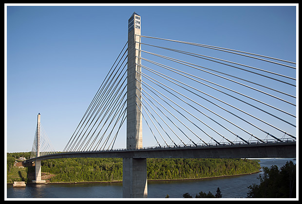 |
Take a one-minute ride on the fastest elevator in northern New England, which will take you to the top of the tallest public bridge-observatory in the world. The observatory lies at the top of one of the bridge towers, a dizzying 420 feet high!
Before crossing the bridge, the Fort Knox Historic site is right nearby, and is one of the best-preserved fortifications on the New England seacoast. Fort Knox was established in 1844 to protect the Penobscot River valley. The bridge itself follows the same design as the Zakim Bridge in Boston, the road lies high above the Penobscot River at 135 feet above the river.
Directions:
-
From US Route 1 in Camden go north through Belfast & Searsport.
-
North of Searsport, turn right at the Stockton Springs sign.
-
Take East Cape Road to Fort Point Rd, turn left at the park's entrance and continue to the park's parking area.
-
If the park gate is closed, continue on Fort Point road to the "Y" intersection and bear left at a large dirt parking lot and go past the entrance to Fort Point State Park.
-
Take the next left for a about a mile to a small dirt parking lot.
For those who are coming in by boat, there is a 200-foot pier at Stockton Springs available for visitors.
Contact Info:
Fort Point State Park
Stockton Springs, Maine
c/o Bureau of Parks and Lands
106 Hogan Road
Bangor, ME 04401
Phone: (207) 941-4014 or (207) 567-3356
Books to Explore

Available in paperback. |
New England's Haunted Lighthouses: Explore the historical mysteries surrounding the haunted lighthouses of New England! This image-rich book features ghost stories about spirits of devoted keepers who linger, victims of foul play or local shipwrecks, ghost ships, lost souls, and more, blending maritime history with the supernatural. Explore the tales linked with these iconic beacons! |
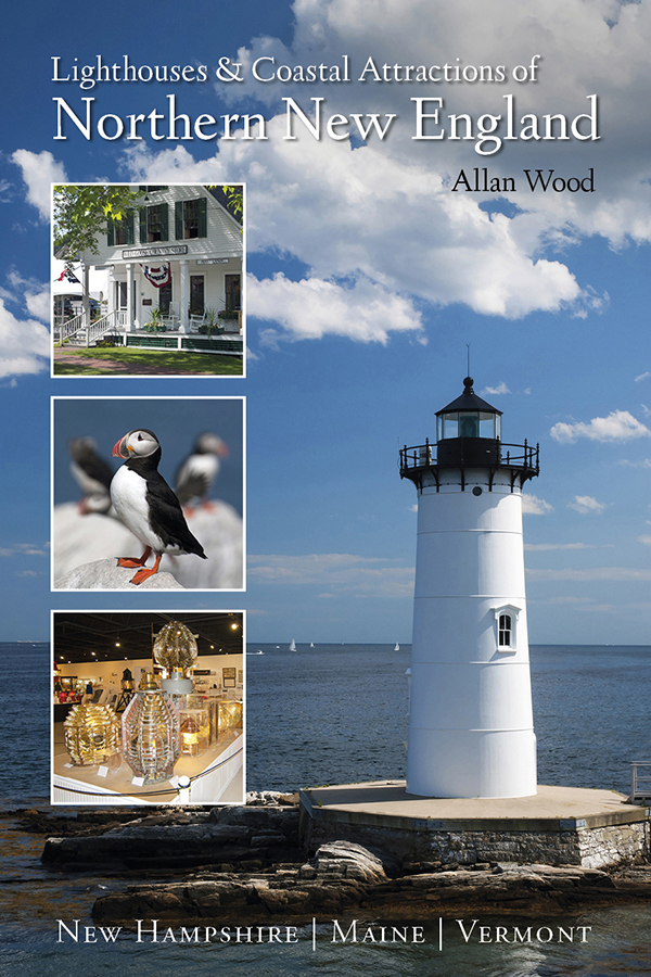
Lighthouses and Coastal Attractions of Northern New England: This resourceful 300-page book provides human interest stories from each of the 76 lighthouses in northern New England, along with plenty of coastal attractions and tours near each beacon, including around the Penobscot Bay region. Look inside! |
|

This book is available in paperback, hardcover, and as an eBook for all devices. |
The Rise and Demise of the Largest Sailing Ships: In the early 1900s, New England shipbuilders constructed the world’s largest sailing ships amid social and political reforms. These giants of sail were the ten original six-masted coal schooners and one colossal seven-masted vessel, built to carry massive quantities of coal and building supplies, and measured longer than a football field! Some of these giants dropped off supplies at Mack Point a few miles away. This self-published book, balanced with plenty of color and vintage images, showcases the historical accounts that followed these mighty ships. |

