Graves Lighthouse
Boston, Massachusetts
Built in 1905
Location:
On a collection of rocky ledges called the Graves, just outside Boston Harbor.
Latitude: 42° 21' 48" N
Longitude: 70° 52' 09" W
Historic Stories:
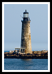
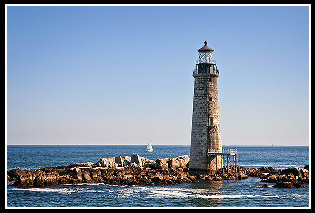
The Graves is a group of jagged rocks on a series of ledges about nine miles offshore from Boston, named after Rear Admiral Thomas Graves, who sailed to Boston with John Winthrop in 1628, not because of the many shipwrecks that occurred there. The challenge to many mariners is that a good portion of these rock formations would be submerged underwater at high tide, especially during severe New England storms.
An iron bell buoy was placed near the ledges in 1854, which was later replaced by a whistling buoy.
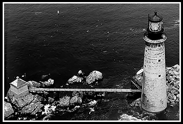
The original lighthouse was built between 1903 and 1905. Its tower made of granite was cut locally from Rockport, in the same style as Maine's Ram Island Ledge Light in Portland. The lighthouse was equipped with a first order Fresnel lens, making it the most powerful light in New England (for some time) and the largest lens at 9 feet by 12 feet high, sitting on over 400 pounds of mercury.
|
The beacon is the tallest lighthouse in the Boston area, and the outermost lighthouse in Boston Harbor. Its first keeper was Elliot C. Hadley in 1905. |
| Even with its powerful light that saved many mariners from crashing on the ledges, there were still some vessels that shipwrecked near the lighthouse. |
|
The Grounding of the Giant Six-Masted Coal Schooner Alice M. Lawrence
On March 29, 1907, the massive six-masted schooner Alice M. Lawrence, measuring over 300 feet along her hull, was heading to Boston with a load of coal, giving her a deep draft of her keel underwater. When she reached outer Boston Harbor, she was picked up to be towed about eleven miles from the shore when she ran aground on a small group of rock outcroppings near the Graves lighthouse about nine miles from shore.
The tide was starting to come in and within two hours the giant schooner was able to float off the rocks and made it to one of the Boston piers to discharge her cargo. Upon inspection it was found the ship had lost about 100 feet of her keel among some other injuries on her hull. She was hauled out to dry dock for repairs as no one was injured.
Wreck of the Schooner Davis Palmer
One of the larger coal schooners of its day, the five-masted British schooner Davis Palmer, left on December 21, 1909 from Newport carrying a load of coal heading towards Boston. On the 24th of December a barge had passed the the 300-foot schooner just off Cape Cod and observed the crew gathered on deck, singing and celebrating Christmas Eve.
On December 26, 1909 the Davis Palmer got caught in a fierce winter blizzard that had entered the bay causing it to run aground on Graves Ledge, a group of dangerous rocks near Graves Lighthouse. The captain tried to drop her anchor on the ledge to hold fast to ride out the storm, but the massive waves lifted the ship off the ledge, and pushed it out into the open waters, as water rushed in from broken timbers in her hull. The schooner with her full load of coal quickly sank, in nearly 40 feet of water, drowning all 14 members of her crew in the icy waters.
City of Salisbury "Zoo Ship" Wreck
The City of Salisbury was a 400-foot British freighter known as the “zoo ship” for its cargo of exotic zoo animals. In April 1938, the ship struck a reef near the Graves Ledge and remained for a time, becoming a tourist attraction until it eventually split and sank. There were no lives lost at the mishap, but there was plenty of blame for Captain Lewis of the vessel.
Years later the Coast Guard investigation would clear Captain Lewis and his Boston pilot at the helm of any wrong doing, finding that “Government Chart #246 was incorrect” in indicating there was over thirty feet of water available, where clearly a portion of the ledge was not mapped.
Note: For more details regarding this famous story, select the link "Wreck of the Zoo Ship" Blog at the top of the page to be directed to my Lighthouse Stories section.
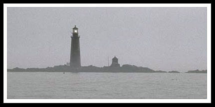
The fog signal house was swept away by the "Perfect Storm" of October 1991.
Contact Info:
Boston Harbor Island Park Service
191W Atlantic Ave
Boston, MA 02110
Phone: (617) 223-8666
Boston Harbor Now
1 Constitution Road
Boston, MA 02129
Phone: (617) 223-8667
Email: info@bostonharbornow.org
Boston's Waterfront Directions
Directions to Boston's Rowes Wharf for Harbor Cruises:
- Heading North:
- Take US Route I-93 North to the Logan Airport (I-90)/S. Station) exit towards Worcester, Exit #20
- Continue towards Frontage Road/South Station
- Bear right towards Kneeland Street/Downtown
- Continue on Atlantic Avenue
- Rowes Wharf is on the right.
- Heading East towards Boston:
- Take Take US Route I-90 East (Massachusetts Turnpike) to the 24 A-B-C/I-93/South station exit towards Concord NH/Quincey.
- Continue towards South Station, Exit #24A
- Continue on Atlantic Avenue
- Rowes Wharf is on the right.
Directions Public Transportation (MBTA):
-
Take the Blue Line to Aquarium Station
-
Turn LEFT immediately out of the station
Continue on Atlantic Avenue -
Rowes Wharf is on the LEFT.
-
Directions to Boston's Long Wharf for Harbor Cruises
- Heading South:
- Take US Route 93 South to Exit 24A bearing right on off ramp (Government Center).
- Follow signs to Aquarium Wharf. Boston Harbor Cruises is located between the Aquarium and Marriott Hotel.
- Heading North:
- Take US Route 93 North to Exit 23 (Government Center).
- Follow signs to Aquarium Wharf.
- Boston Harbor Cruises is located between the Aquarium and Marriott Hotel
Local Boat Tours For Visitors
Occasional tours are offered by the Boston Harbor Cruises and Friends Of Boston Harbor Islands pass by the lighthouse. Boston Harbor Island Park Service also passes close to the lighthouse on its 3 hour narrated summer tours to climb Boston Light on Little Brewster Island.
Boston Harbor Islands Park Service and Boston Harbor Now
Narrated trips by the park rangers are provided during the summer along Little Brewster Island where you can see Boston Harbor Light, Graves Light, and Long Island Head Light. They are directly involved in preservation of islands in the harbor. Boston Harbor Now is the non-profit partner of the 34-island Boston Harbor Islands National and State Park.
Note: Boston Harbor Lighthouse is undergoing extensive repairs from nasty winter storms, therefore, there are no tours of the lighthouse tower in 2024.
Boston Harbor Island Park Service
191W Atlantic Ave
Boston, MA 02110
Phone: (617) 223-8666
Boston Harbor Now
1 Constitution Road
Boston, MA 02129
Phone: (617) 223-8667
Email: info@bostonharbornow.org
Books to Explore
New England's Haunted Lighthouses: 
Available in paperback. |
Discover the historical mysteries surrounding the haunted lighthouses of New England! This image-rich book features ghostly tales of devoted keepers who refuse to leave, ghost ships, shipwreck victims, and restless spirits searching for peace. These narratives offer a glimpse into the past, intertwining factual events and history with maritime legends, myths, and lore. Immerse yourself in the spectral stories associated with these iconic beacons! |
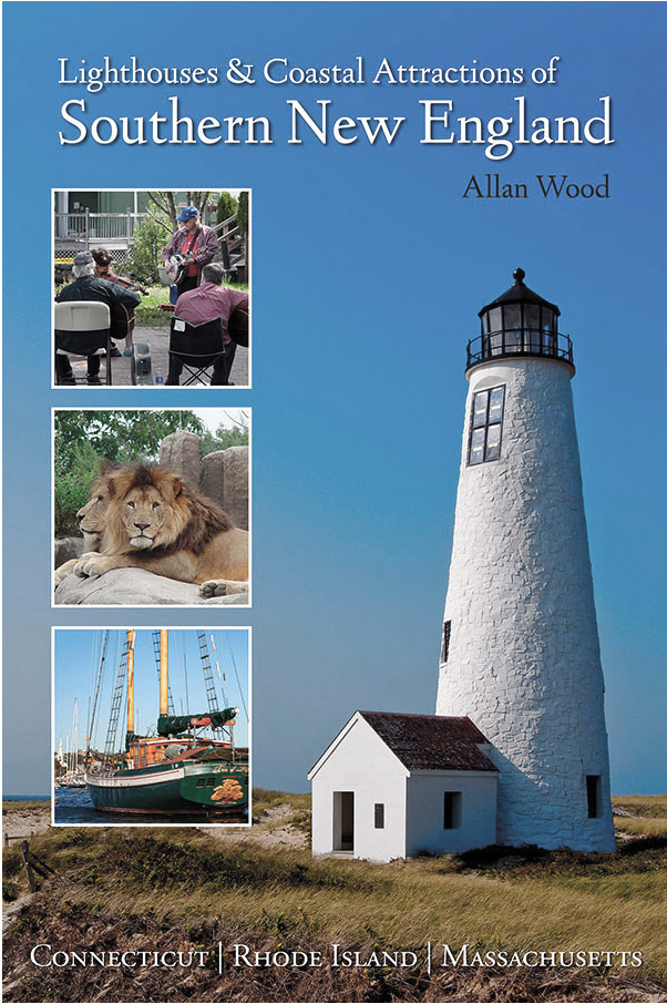
Lighthouses and Coastal Attractions of Southern New England: Connecticut, Rhode Island, and Massachusetts This book, published by Schiffer Publishing, provides special human interest stories from each of the 92 lighthouses, along with plenty of indoor and outdoor coastal attractions and tours you can explore. In the book you'll find local stories from all lighthouses in the Boston area region, including more stories about Graves light, and more details about the City of Salisbury zoo ship, and lots of Boston attractions and boat tours. Look inside! |
|
Available in paperback, hard cover, and as an eBook for all devices. |
The Rise and Demise of the Largest Sailing Ships: In the early 1900s, New England shipbuilders constructed the world’s largest sailing ships amid social and political reforms. These eleven giants of sail were built to carry massive quantities of coal and building supplies, and measured longer than a football field! This book, balanced with plenty of color and vintage images, showcases the historical accounts that followed these mighty ships. These true stories include competitions, accidents, battling destructive storms, acts of heroism, and their final voyages. In fact, one of these ships grounded in the rocks by Graves Light. |

