Sankaty Head Lighthouse
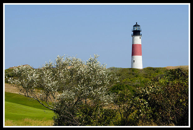
Siasconset, Massachusetts
Built in 1850
Location:
The lighthouse is located on the eastern end of Nantucket, just north of Siasconset.
Latitude: 41° 17' 01" N
Longitude: 69° 57' 54" W
Historic Stories:
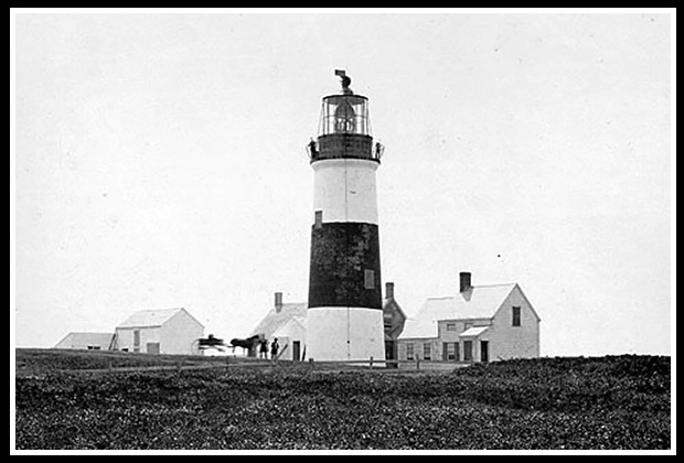
Sankaty Head Lighthouse was unique for its time in that it had not only a fixed light but also flashing lights to distinguish it from the numerous other lighthouses in the area. When it was built in 1850, towering almost 160 feet above sea level, it received a second-order Fresnel lens from Paris, which was the new type of lens of its day using glass and reflectors to accent the light. It was the first lighthouse with a Fresnel lens installed in the United States.
This original 1850 lens was illuminated by a single-wick lamp that would consume over 400 gallons of whale oil per year.
| Sankaty Head Lighthouse soon became known as New England's most powerful beacon, and could reportedly be seen as far as 40 miles away. |
Early Sankaty Head Light |
Coskata Lifesaving Crew Rescues the H.P. Kirkman
One of the most famous rescues off Nantucket Island occurred when Keeper Walter N. Chase and his six-man Coskata lifesaving crew, known as "surfmen", stationed near Great Point lighthouse, were involved in the rescue of the crew of the H.P. Kirkman, which was in distress and sinking ten miles off shore from Nantucket Island, during a fierce winter storm in January of 1892. Through the gale force winds and turbulent seas they reached the stranded frozen crew members of the H.P. Kirkman, but were unable to make headway towards their goal of reaching Sankaty Head lighthouse, which was closer than Great Point light.
They had to anchor their lifeboat for many hours, as lifesavers and survivors were starting to get frostbite from the freezing winds and spray. By sunrise the following day, as the tide came up, and the winds started to calm, the exhausted lifesavers reached Siasconset Beach, near Sankaty Head lighthouse, hours later, after nearly 26 hours of having been out in the freezing seas.
The seven crew members of the H.P. Kirkman all survived the wreck, and Keeper Chase and his crew were awarded lifesaving medals.
Nantucket Lightship Collision with the RMS Olympic
The Nantucket Lightship LV-117 was stationed south of the Nantucket Shoals about 42 miles southeast of Sankaty Head Lighthouse in an area of heavy shipping traffic. On May 15, 1934, when heavy fog had engulfed the region that night, the lightship sounded her fog horn for the incoming, ocean liner, RMS Olympic, which was about 75 times the size of the lightship.
Although following the Nantucket’s radio beacon signal, the lookout on the RMS Olympic had miscalculated the location of the lightship and was unable to see the lightship in the fog until she was about 500 feet from colliding with the doomed vessel. The crewmen of the Nantucket sounded the alarm for the impending collision and grabbed their life preservers as the RMS Olympic came towards them. The great ocean liner ran over the Nantucket, cutting it in half, as the lightship sank within minutes. Seven of the eleven lightship crewmen drowned in the frigid waters and four were rescued, including Captain George Braithwaite, who died a few months later from his injuries.
For more details about the story of the Nantucket Lightship collision or the Rescue of the H.P. Kirkman, select the appropriate link at the top of the page to be directed to my Lighthouse Stories section.
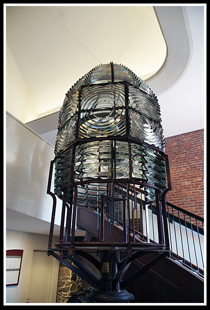 |
The lens was used for 100 years until it was replaced in 1950 by modern rotating aero beacons. The original Fresnel lens can now be seen at the Nantucket Whaling Museum. |
The light was automated in 1965, but Coast Guard personnel continued to occupy the station until 1992, with the personnel reportedly hearing and seeing strange paranormal events, which included pots and pans that would fly on their own. Whenever the ghost or whatever it was, was asked to stop, the activity would cease.
Sankaty Head was also threatened from constant erosion and was gradually getting closer to the edge of the high cliff bluff it was sitting over, and was 72 feet from the bluff’s edge by 2006. The 'Sconset Trust took ownership of the beacon in 2007, raised the necessary funds, and moved the 400-ton lighthouse from its original site during October 2007.
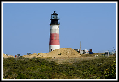
Sankaty Head Light
Preparing for Move in 2007
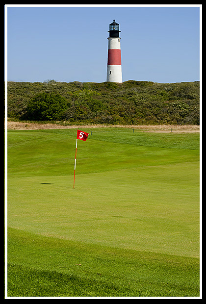
It presently stands 267 feet away from the bluff’s edge next to the Siasconset Golf Course that surrounds it.
Places to Visit:
The lighthouse grounds are open to the public daily from sunrise to sunset during the summer months. It is also open on special days for visitors to climb up the tower.
| The town of Siasconset lies in a very quiet picturesque area on Nantucket with nearby beaches and the Siasconset Golf Course, which practices “pasture golf” where visitors can play in casual clothing and enjoy the views by the lighthouse. |
|
Sankaty Head now sits adjacent to the golf course about a mile north of the village of Siasconset. The Coskata-Coatue Wildlife Refuge lies a few miles way where a naturalist guide provides visitors a tour on a four-wheel sand buggy through the salt marsh to learn about the geology, ecology, and history of the area and to climb the Great Point Lighthouse.
The Nantucket Whaling Museum coordinated by the Nantucket Historical Association, contains a major collection of all artifacts involving the whaling industry in the 19th century. The Nantucket Shipwreck & Life Saving Museum, provides lots of info and artifacts about rescues and shipwrecks that occurred in Nantucket's history, along with plenty of lifesaving artifacts, tools, and memorabilia.
Directions:
-
Both the Steamship Authority and Hy-Line Cruises offer ferry service to Nantucket from Hyannis. From the Steamboat Wharf in Nantucket, proceed up Broad Street to South Water Street.
-
Turn left on South Water Street and then turn right on cobble-stoned Main Street.
-
From Main Street, turn left on Orange Street and continue for just over a mile to the rotary.
-
At the rotary, go east on Milestone Road about six and a half miles to Siasconset.
-
Milestone Road will turn into Main Street, which leads to the center of town, where you will turn left on Shell Street.
-
Shell Street will merge into Sankaty Road.
-
From Sankaty Road turn right onto Bayberry Lane and the left onto Baxter Road, which will end at the lighthouse.
Note: Sankaty is also accessible by taking the Nantucket shuttle to Siasconset, and getting off just south of the golf course.
Contact Info:
The 'Sconset Trust, Inc.
One New Street
Siasconset, MA 02564
Phone: (508) 257-4100
Ferries to Nantucket Island
The ferries mentioned don’t pass by the lighthouse, but provide services to get to the island of Nantucket from either the mainland or between the islands.
Hy-Line Cruises
Hyannis-Oak Bluffs ferry; also Nantucket-Oak Bluffs ferry.
220 Ocean Street Dock
Hyannis, Massachusetts 02601
Information: (508) 778-2600
Oak Bluffs (508) 693-0112
Hyannis-Nantucket ferry (508) 778-2602
Steamship Authority
Ferries to both islands
Vehicle Reservations Call: (508) 477-8600
Office Hours or (508) 693-9130
Fast Ferry Reservations: (508) 495-FAST (3278)
Woods Hole: (508) 548-3788
Vineyard Haven: (508) 693-0367
Oak Bluffs: (508) 693-0125
Hyannis: (508) 771-4000
Nantucket: (508) 228-0262
Freedom Cruise Line
Ferry from Harwich Port Mass. to Nantucket
702 Main Street - Route 28
Harwich Port, Massachusetts 02646
(508) 432-8999
Nantucket Island Tours
Provides bus tours and group charters around the island.10 Washington St.
Nantucket, MA 02554
Phone: (508)228-0334
Email: info@nantucketbustours.com
Books to Explore
New England's Haunted Lighthouses: 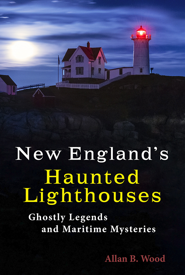
Available in paperback. |
In this image-rich book, discover the historical secrets of the haunted lighthouses of New England! Reliable witnesses have reported numerous ghostly encounters, including the spirits of dedicated keepers who refuse to leave, phantom ships, victims of misfortune, restless souls from nearby shipwrecks, and more. Immerse yourself in the tales connected to these iconic landmarks, blending maritime history with the paranormal. |
Lighthouses and Coastal Attractions of Southern New England: Connecticut, Rhode Island, and Massachusetts This book provides special human interest stories from each of these 92 lighthouses on the southern coastline, along with plenty of indoor and outdoor coastal attractions and tours you can explore. Look inside! |
|
 Available also from bookstores in paperback, hardcover, and as an eBook for all devices. |
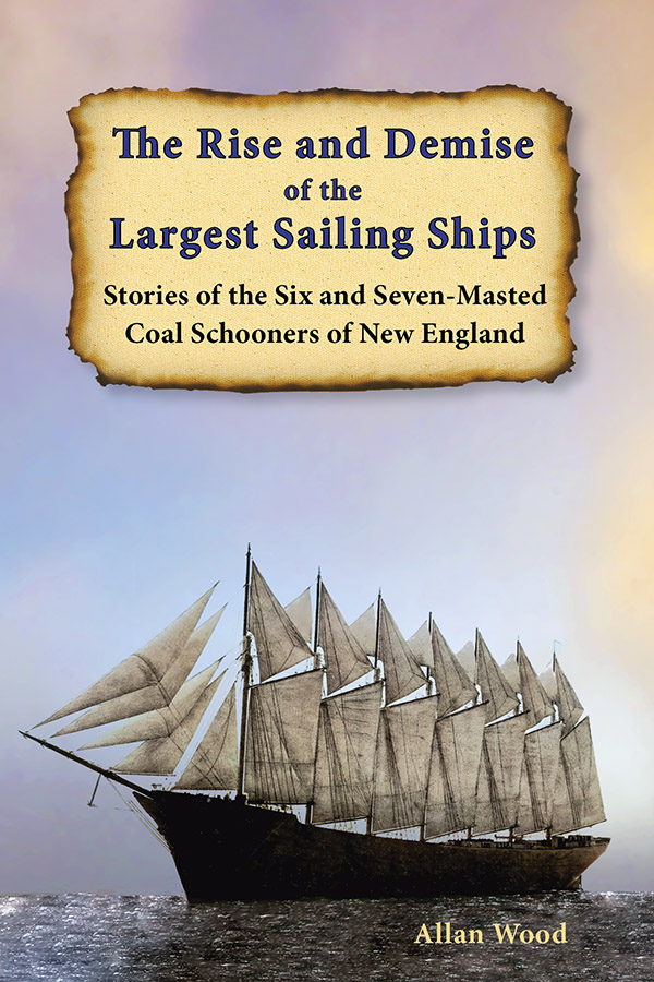
The Rise and Demise of the Largest Sailing Ships: In the early 1900s, New England shipbuilders constructed the world’s largest sailing ships amid social and political reforms. These giants of sail were the ten original six-masted coal schooners and one colossal seven-masted vessel, built to carry massive quantities of coal and building supplies, and measured longer than a football field! This self-published book, balanced with plenty of color and vintage images, showcases the historical accounts that followed these mighty ships. In fact, many of these events occurred while sailing around the dangerous shoals of Cape Cod and the islands during stormy weather. |
New England Lighthouses: Famous Shipwrecks, Rescues & Other Tales This image-rich book contains over 50 stories of famous shipwrecks and rescues around New England lighthouses, and also tales of hauntings. Included is the story of the coordinated rescue of survivors of the Andrea Doria south of Nantucket Island. You'll also learn about lightships stationed on the Nantucket Shoals around the islands. You'll also find more details and imagery on the tragic story of the collision between the Nantucket Lightship LV-117 and the RMS Olympic. |
You'll find this book and my lighthouse tourism books from the publisher Schiffer Books, or in many fine bookstores.

