Isle La Motte Lighthouse
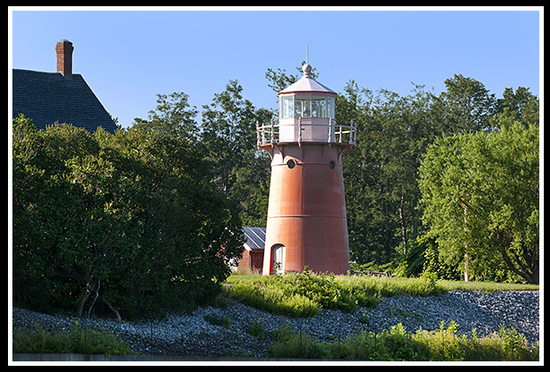
Isle La Motte, Vermont
Built in 1881
Location:
Located on Isle la Motte Island in northern Lake Champlain a few miles from the Canadian border.
Latitude: 44° 54' 19" N
Longitude: 73° 20' 39" W
Historic Stories:
In the mid-1600’s, the first French outpost on Lake Champlain’s Vermont was built on the Isle La Motte island. The largest battle fought on Lake Champlain was located near this site known as the Battle of Plattsburgh, during the War of 1812 and was a major American victory.
With the completion of the Champlain canal in 1823, shipping traffic dramatically increased into New York, especially the lumber traffic coming down from Canada, and marble from the nearby quarries. Shipping companies started to place navigational aids around the channels and islands of Lake Champlain. A lantern was hung from a large pine tree in 1829 on the Isle La Motte northern point to help mariners around the island and through the channel. The light was later moved to the upper attic window of a nearby stone house, which is still a private residence today.
The US Government realized the need for more permanent structures with on site keepers along Lake Champlain. In 1856, the government replaced the makeshift light with a light on a pyramidal limestone tower, tended by a local farmer. The problem was that on many stormy nights, the light would simply blow out as the farmer had to still travel a distance to get to the lighthouse, causing petitions from the locals for a more permanent lighthouse.
A permanent lighthouse was finally approved by the lighthouse board and built on the premises in 1881 with a keeper’s dwelling, with Wilbur Hill as its first and only Keeper. From his dedication to his duties, Hill received awards for having the best-kept station in the district. He stayed on for 48 years while he also tended his 100-acre farm nearby.
The light was replaced by a skeletal tower in 1933, and sold in 1949 to the Clark family, who’s son would later purchase nearby Windmill Point light in the early 1960’s.
| In 2001, the Coast Guard decided that it would be more cost effective to replace the light on the tower then to maintain the deteriorating skeletal tower, and the tower was relit in 2002 with over 300 locals attending. | 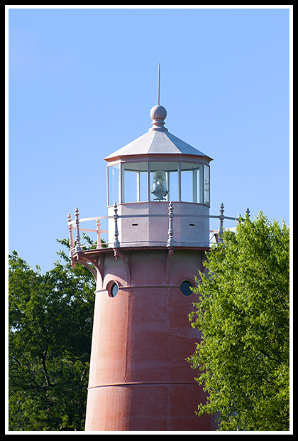
|
Places to Visit Nearby:
Isle La Motte lies in the northwestern corner of Vermont, seven miles long, it is the northernmost island of Lake Champlain with hardly any traffic.
The Isle La Motte lighthouse stands on the island's northwest corner but access is very restricted as it is a private residence. The beacon is best viewed by boat.
The island itself is a quiet serene area to bike on relatively flat terrain, or to kayak around the island, which you can also rent there. There is an old schoolhouse that houses the historical society and a museum. The Isle La Motte library is a well-crafted stone building constructed of local limestone.
Fisk Farm on the island hosts cultural heritage programs of various arts and musical events.
The island is also part of remarkable natural phenomenon known as the Chazy Fossil Reef. It is the oldest exposed reef in the world, where the bedrock of the southern third of the island displays primitive fossil remnants from 480 million years ago. Millions of years ago the reef tilted, so a visitor today can walk from south to north and observe the change in geology and fossil remains from the oldest to the youngest sections of the reef. It is part of the Fisk Quarry Preserve, which you can visit.
| Many boaters enjoy frequenting the waters around the islands, and viewing dramatic sunsets. | 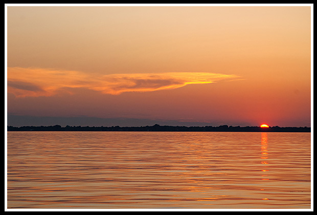 |
The area surrounding the island and the nearby mainland offers picturesque views of farmlands, forests, and wetlands. The area contains a system of well-groomed trails for bikers and hikers alike, and for cross country skiers and some snowmobilers in the winter.
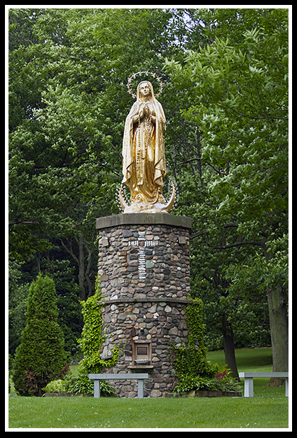
| On the Isle La Motte, there is a flat terrain bike trail called the Isle La Motte Ramble, a 10-mile biking trail that offers lake views, quiet roads, ancient rocks, and the famous Saint Anne’s Shrine, where the first known mass in Vermont was celebrated. |
Saint Anne's Shrine |
- Another 10-mile biking trail near an island southward called North Hero is known as the Isle La Motte: Another Side of Vermont.
- The Central Vermont Rail Trail in St. Albans offers 27 miles of remote Vermont scenery for those who enjoy horseback riding, mountain biking, hiking and winter sports such as cross-country skiing and snowmobiling.
- The St. Albans Rail Trail provides a nice long bike ride along the Lamoile River, dotted with restaurants and gas stations.
- The Missisquoi Valley Rail Trail in St. Albans is a 26-mile bike trail between the nearby towns of St. Albans and Richford through farms, forests, and wetlands. This trail is less than 1 mile from the Champlain Bikeway at St. Albans Bay and the Route Verte in Canada may be accessed from the Richford end of the Trail.
|
There are many islands in this area, lots of attractions around these islands, with the largest ones you can drive to and enjoy the serene scenic views and stay at various state parks. |
South of Isle La Motte, you can enjoy a relaxing retreat and beach swimming at Knight Point State Park on the island of North Hero.
Grand Isle is the largest island on Lake Champlain at 14 miles long, which also contains the town of South Hero. It is the home of the Hyde Log Cabin, built around 1783, by one of the islands pioneer settlers, Capt. Jedediah Hyde and is one of the oldest cabins in the United States.
| Grand Isle State Park, located in South Hero, provides plenty of camping adventures, boating, fishing, and kayaking and nature walks. | 
|
You can also take the Grand Isle-Cumberland Head Ferry to the New York border at Plattsburg. Keeler Bay, in South Hero has ancient limestone rock formations millions of years old. Much of the area in South Hero is protected from commercial development by the South Hero Land Trust. They host many farmers’ market events and other farm type events for visitors and locals alike.
Directions:
The lighthouse is best viewed by boat, as it is a private residence where the grounds and tower are closed to the public, and the road may be blocked from visitors.
-
To view the lighthouse from distance, where you may still need permission to access the road:
- From Route 2, which runs along the islands of Lake Champlain,
- Turn onto Route 129 and follow it onto Isle La Motte.
- Turn right onto Shrine Road and then take another right onto Lighthouse Point Road, where you may be able to see the light from a distance.
Books to Explore
New England's Haunted Lighthouses: 
Available in paperback. |
In this image-rich book, discover the historical secrets surrounding the haunted lighthouses of New England! Respectable witnesses have reported numerous ghostly encounters, including the spirits of devoted keepers who refuse to leave, phantom ships, victims of misfortune, restless souls from nearby shipwrecks, and more. Explore the stories connected to these iconic beacons, blending maritime history with the paranormal. |
My 300-page book (with over 360 images), Lighthouses and Coastal Attractions of Northern New England: New Hampshire, Maine, and Vermont, provides stories from each of the 76 lighthouses, along with plenty of coastal attractions and tours near each beacon. Look inside! |
|

