Bristol Ferry Lighthouse

Bristol, Rhode Island
Built in 1855
Location:
Off Route 144 under the Mount Hope Bridge by Roger Williams University, in Narragansett Bay. Private residence. Grounds are not open to the public.
| Latitude: 41° 38' 34" N |
| Longitude: 71° 15' 37" W |
Historic Stories:
Before the lighthouse was constructed, a ferry was used for many generations to transport passengers and commerce between Boston and Newport through Providence. The ferry operated until 1865, when a railroad line was established between Newport and Fall River. The Bristol Ferry name stayed with the location of the lighthouse, and hence became the beacon’s name.
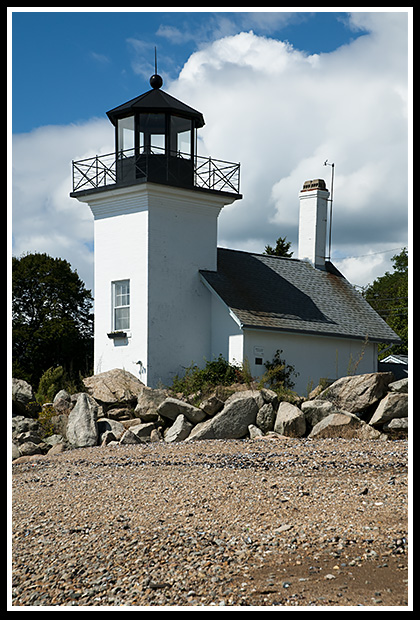
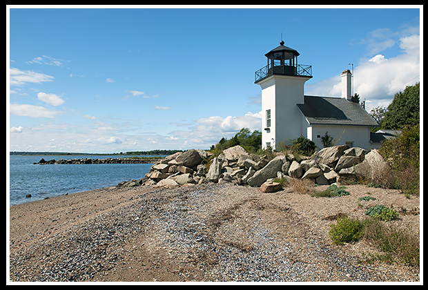
Bristol Ferry lighthouse was built in 1855 to guide the increasing whaling and fishing vessels between the narrow passage of Mount Hope Bay and the larger Narragansett Bay.
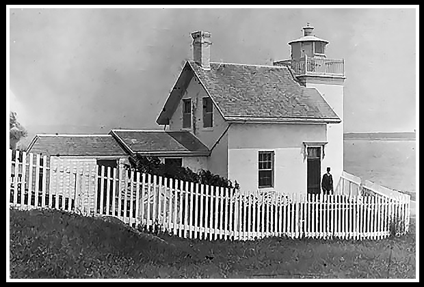 1884 Vintage Image Courtesy US Coast Guard |
The first three keepers died within months after tending the lighthouse which many believed to be from the constant dampness. |
The first keeper was George Pearse, who stayed on for only two months. Henry Dinman followed, but died less than a year later. His wife Elizabeth took over as the only woman lighthouse keeper at the lighthouse, but she too died within six months of her appointment.
| The reason for the dampness, with Bristol Ferry lighthouse, involved it’s being built on a depression of land that would cause it to constantly flood during storms. | 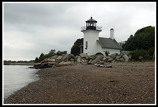
|
This always would create havoc with its keepers who consistently complained about the dampness of the structure.
The floor was never raised, and the keepers would always become ill, some fatally.
In 1927, while the Mount Hope River Bridge was being built above the structure, Bristol Ferry Lighthouse was terminated. The lantern was removed years later, and new owners Robert and Carol Lundin refurbished the deteriorating structure in the 1990s and installed a new tower. The beacon remains a private residence today.
|
Boulders surround the structure to protect it from storms or storm surges from abnormally rising tides into Narragansett Bay. |
Places to Visit Nearby:
Bristol hosts a diverse range of eclectic shops and restaurants, with plenty of shoreline views, parks like Cedarcrest Park and Cohelo Park. This is a nice area for boaters and to kayak as well, including along the harbor.
| The lighthouse is under the Mount Hope Bridge by Roger Williams University, and if you stay away from the private grounds on the University side, you can still get nice photos of the structure. | 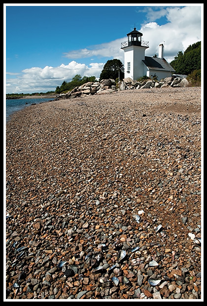 |
I was lucky enough to find the owner agreeable to allow me to take some close ups, he was very helpful. There is a tiny parking lot by the shore to get out and take quick pictures.
| The Bristol - Prudence Island Ferry provides you access to Prudence Island, where you can hike a mile along a path to visit Sandy Point (Prudence Island) lighthouse. | 
Beach at Prudence Island |
The East Bay Bike Path is a scenic 14.5-mile paved trail, running from Bristol to Providence. Very scenic and an easy ride.
Directions:
-
Take Route 144 South to the Mount Hope Bridge.
-
From the northern end of the Mount Hope Bridge, take Old Ferry Road down to the foot of the bridge where you will see the lighthouse.
-
Park at the Roger Williams University parking lots on the right (let security there know you are going to the lighthouse) then you can walk a short distance down to the lighthouse.
-
You can view the lighthouse from the beach, as it is a private residence.
Local Boat Tours
Save the Bay Tours
Organization for lighthouse and coastal preservation provides nature and seal watching tours. For those who are not in a hurry, they provide an extensive 7-hour Ultimate Lighthouse Tour covering most of the lighthouses in Narragansett Bay. The cruise includes a stopover lunch to explore the grounds of Rose Island Lighthouse.
100 Save the Bay Drive, Providence, RI 02905
Phone: (401) 272-3540
Books to Explore
New England's Haunted Lighthouses: 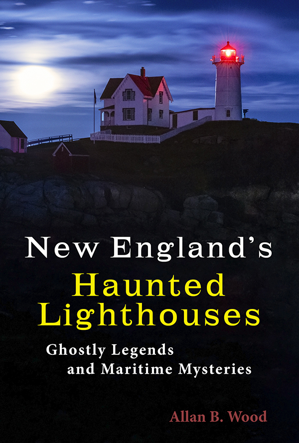
Available in paperback. |
In this image-rich book, discover the historical secrets surrounding the haunted lighthouses of New England! Respectable witnesses have reported numerous ghostly encounters, including the spirits of devoted keepers who refuse to leave, phantom ships, victims of misfortune, restless souls from nearby shipwrecks, and more. Immerse yourself in the stories connected to these iconic landmarks, blending maritime history with the paranormal. |
Available in paperback, hard cover, and as an eBook for all devices.
|
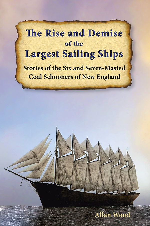
The Rise and Demise of the Largest Sailing Ships: In the early 1900s, New England shipbuilders constructed the world’s largest sailing ships amid social and political reforms. These giants of sail were the ten original six-masted coal schooners and one colossal seven-masted vessel, built to carry massive quantities of coal and building supplies, and measured longer than a football field! This book, balanced with plenty of color and vintage images, showcases the historical accounts that followed these mighty ships involving competitions, accidents, battling destructive storms, acts of heroism, and their final voyages. |
Lighthouses and Coastal Attractions of Southern New England: This book showcases special human interest stories from each of the 92 lighthouses that inhabit the southern coastline, along with plenty of indoor and outdoor coastal attractions you can explore, and tours. There are stories of devastation created by the Hurricane of 1938, and of some remarkable rescues. Look inside! |
|